[Maps]
(Scroll down for interactive maps)

Volcanic features, Northeastern Chile (Created with Blender and Affinity Designer)
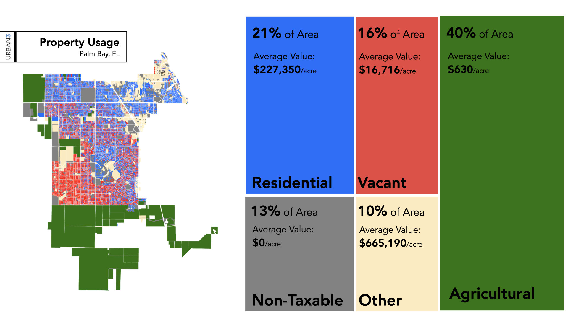
Employment distribution of Palm Bay, FL (Created in ArcMap & Illustrator)
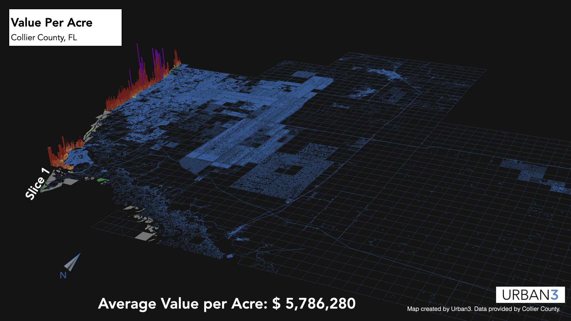
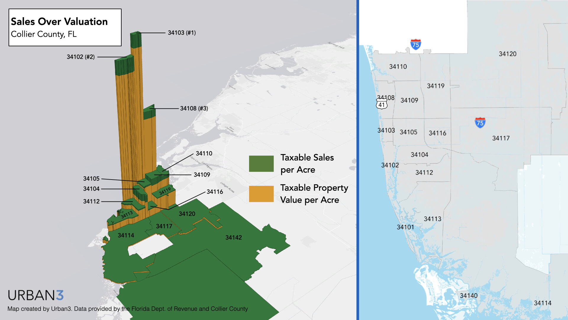
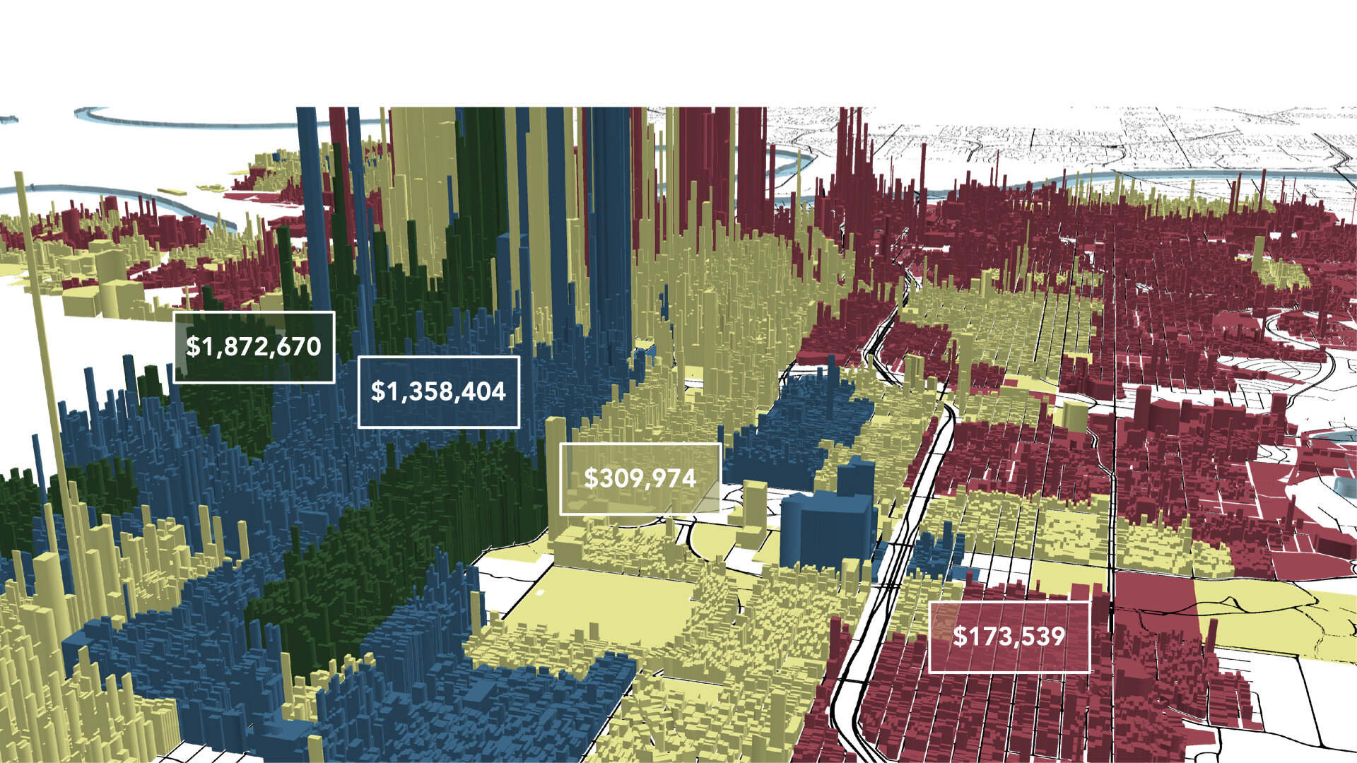
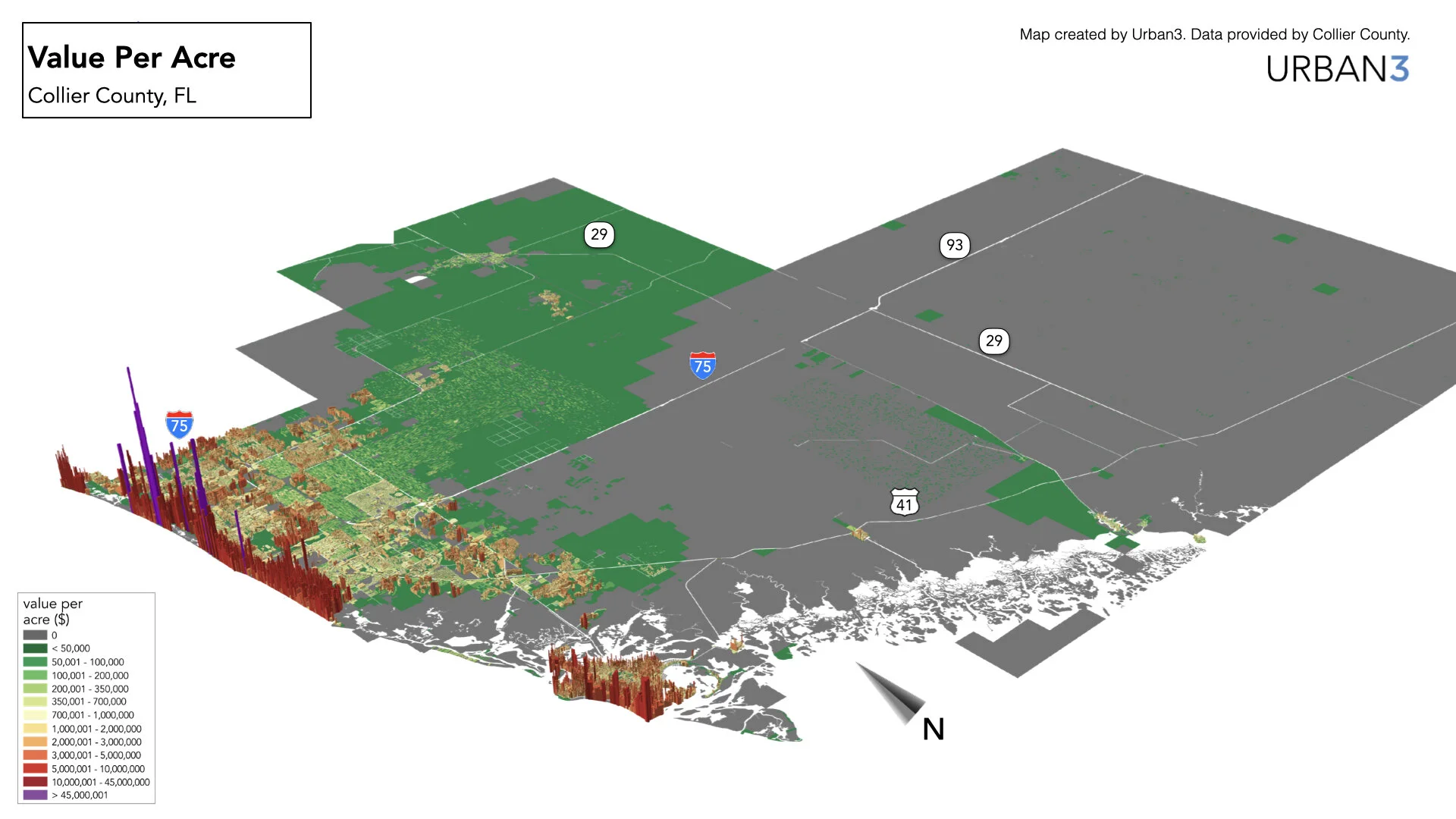
Coastal Property Value, Collier Co, FL (Created in ArcGIS and Affinity)

Scene from value map (Created in QGIS & Blender)

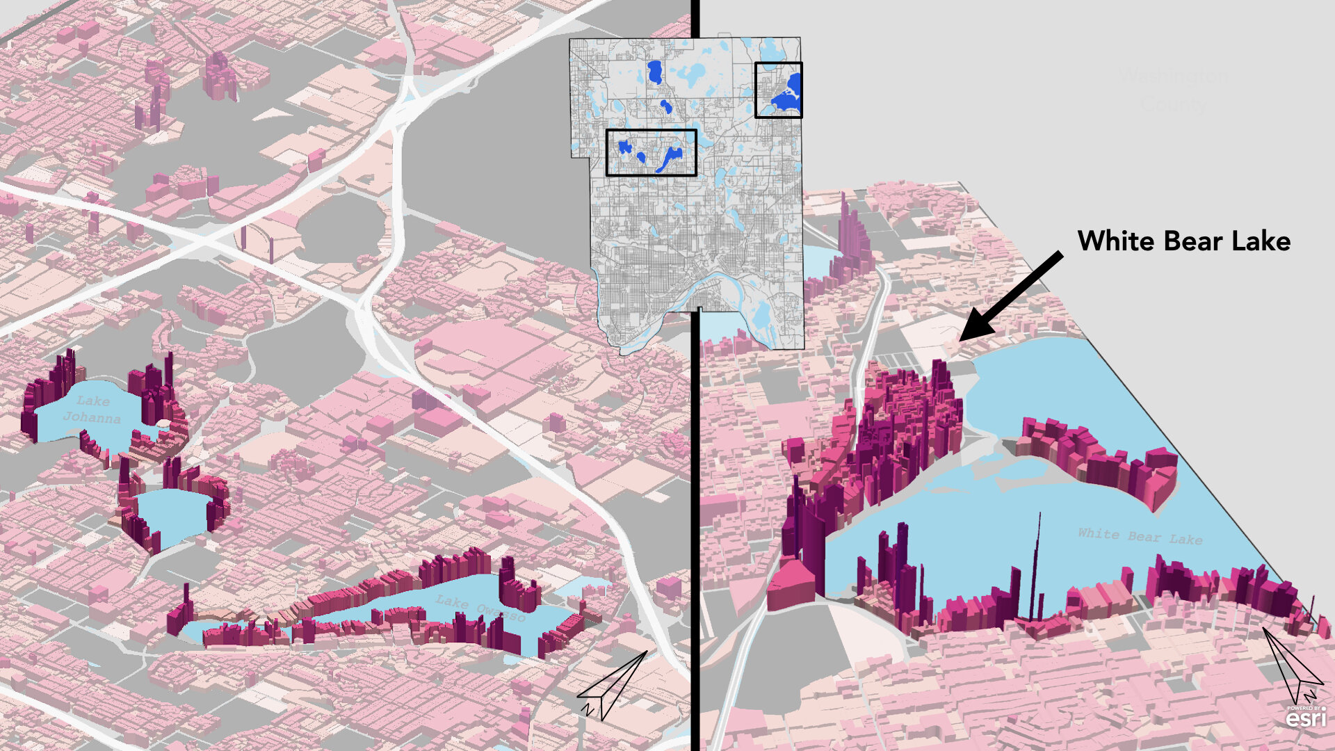
Land Value Density, Minneapolis, MN (Created in ArcGIS)
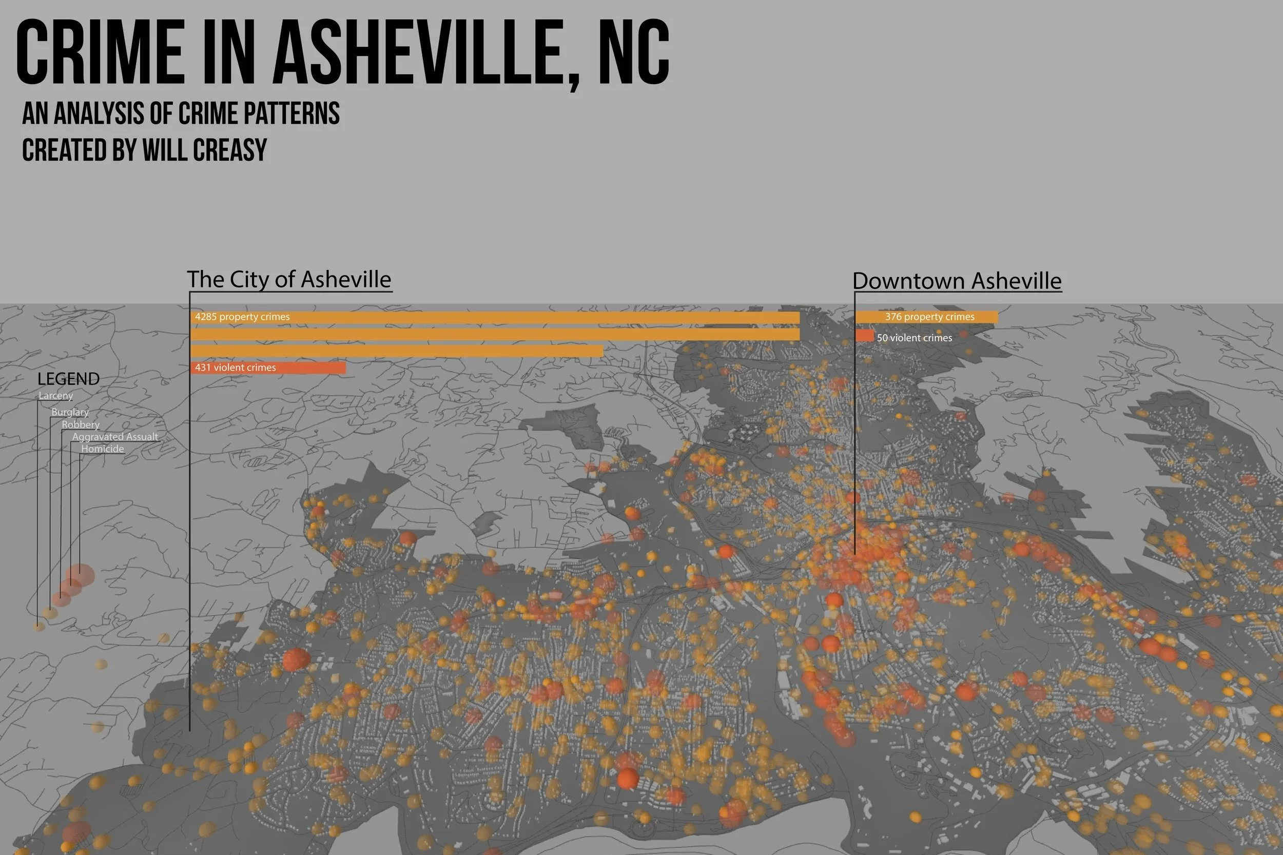
Crime Analysis of Asheville, NC (Created in QGIS)

Crime Analysis of Asheville, NC (Created in QGIS)
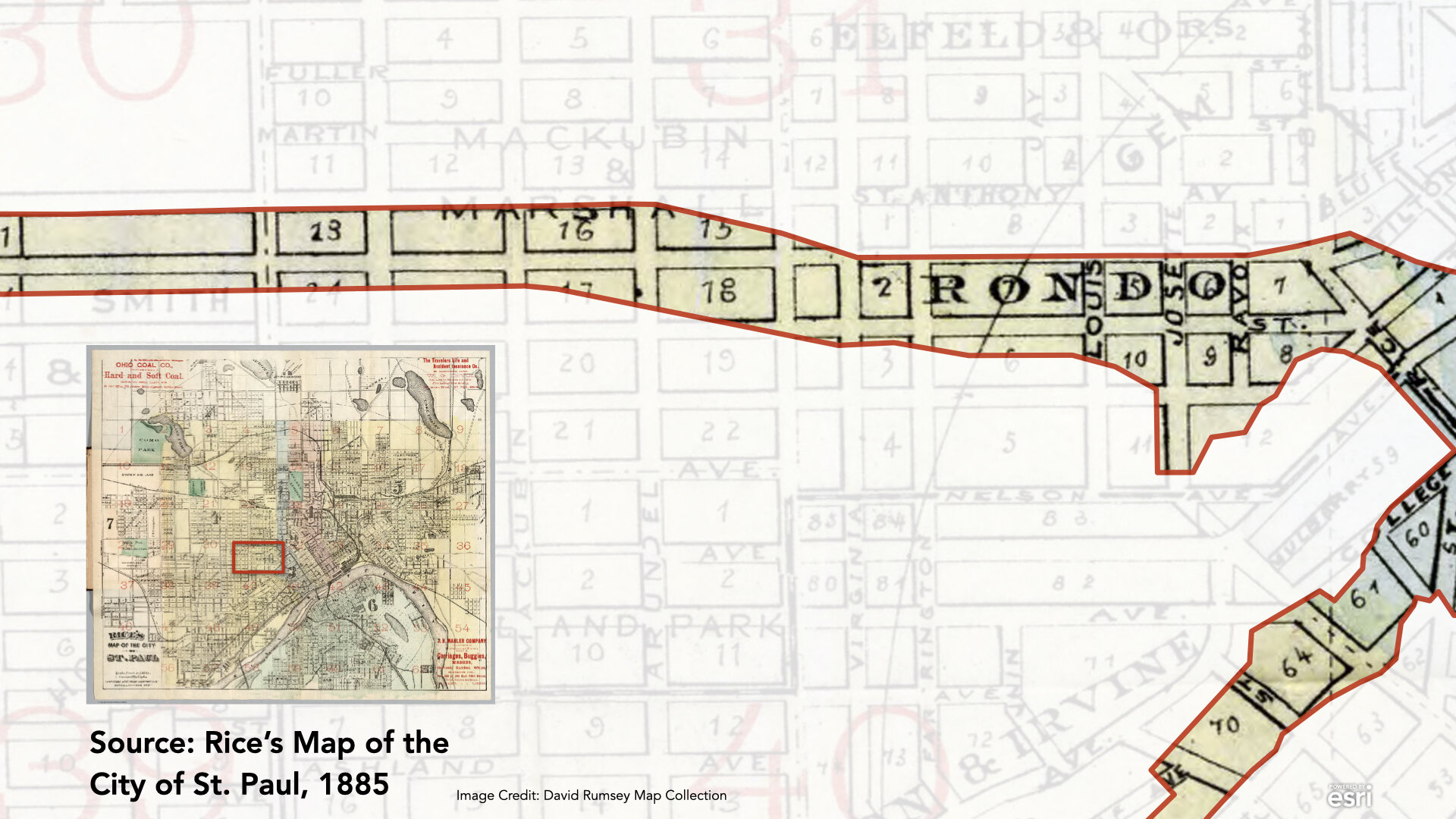
Loss of living area due to highway construction, St. Paul, MN (Created in Illustrator)
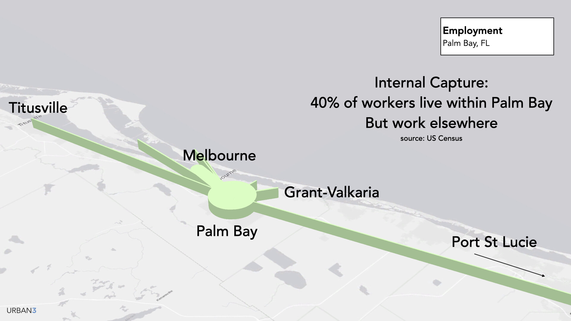
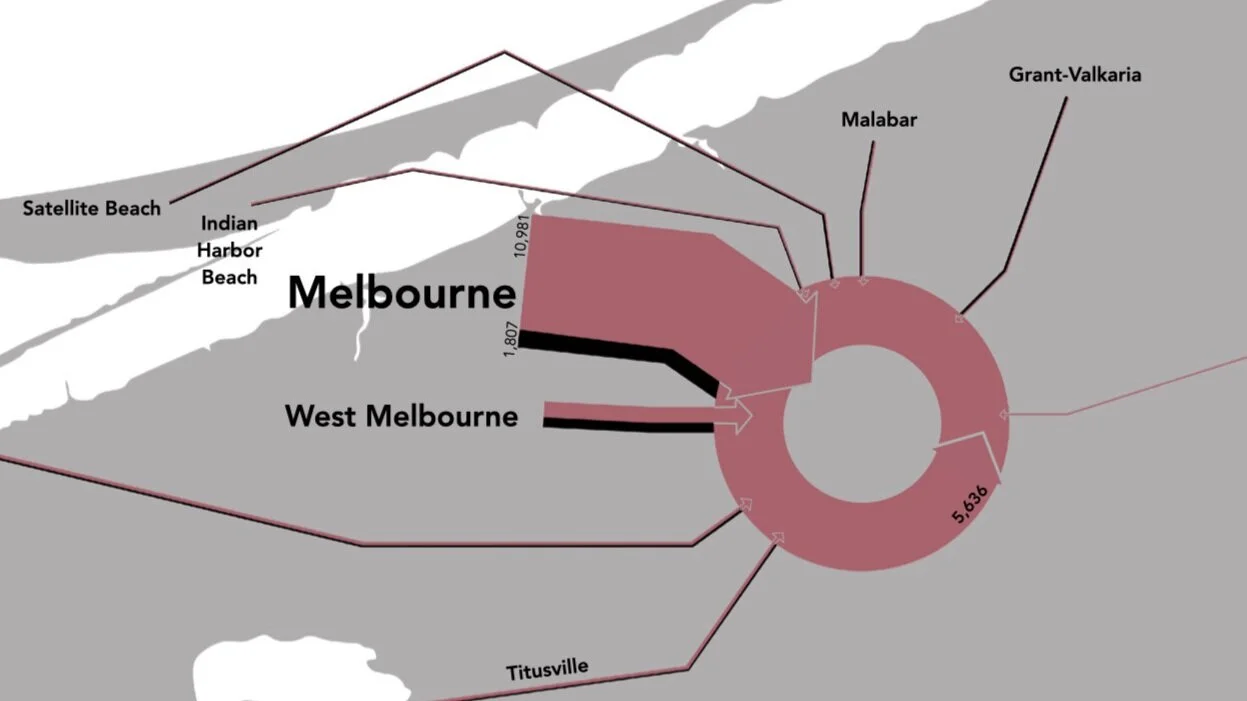
Employment Capture, Space Coast, FL (Created in Blender)

Horshoe Bend, Grand Canyon (Created in ArcMap & Photoshop)
Urban design concept (Created in ArcGIS and InDesign)
Map showing value loss due to redlining (Created in ArcScene and Illustrator)

Map showing value loss due to redlining ( Created in ArcMap, Blender, and Illustrator)

Crime Analysis of Asheville, NC (Created in QGIS)

Crime Analysis of Asheville, NC (Created in QGIS)

Flood analysis of Buncombe County, NC (Created in ArcGIS Pro)

Buncombe County, NC (Created with QGIS and Photoshop)

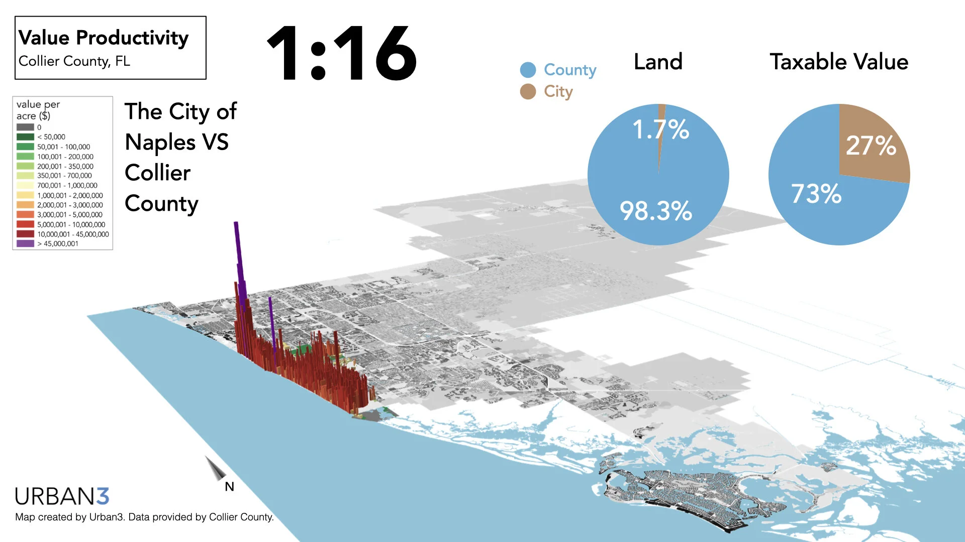
Value productivity map of Bozeman, MT. (Created in ArcMap & Blender)
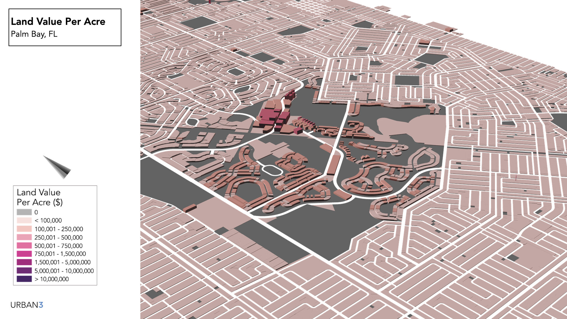
Land Value Density in Palm Bay, Fl (Created in ArcGIS)
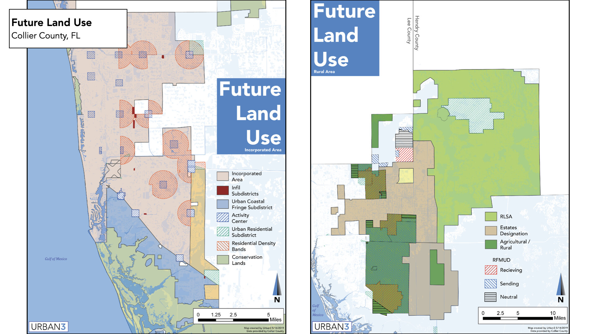
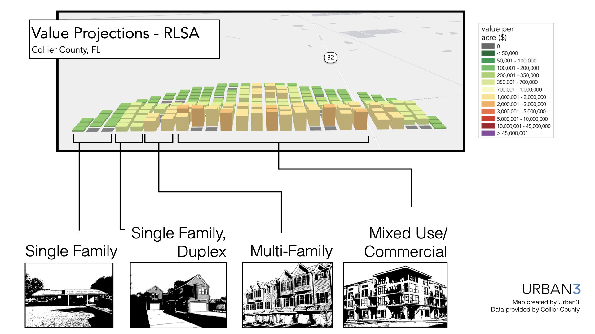
Future land use plan for Collier County, FL (Created in ArcGIS and Illustrator)